Friday, September 12, 2014

Hotting up in the NT


When we bought fruit and vegies from a Kununurra orchard,
we were greeted by the family pet.
We left Kununurra, quite reluctantly, but looking forward to new adventures just across the border in the Northern Territory. It was just a short drive of less than 300km to the Victoria River Roadhouse, beside the Victoria River, obviously, with a campground, bar and restaurant.

While we were having a meal that night, we were chatting to the driver of a low loader who’d pulled in. When he heard we’d come across the Plenty Highway from Boulia to Alice Springs, he told us he’d come from that area, worked as a rodeo clown, and in the 1980s had worked on Macsland, a property being run by a cousin of mine.

I told him I had family links to the area and he then astonished me by saying the young fellow 
Spear grass as tall as the truck near Victoria River.
helping behind the bar . . . who was also a helicopter pilot based there doing scenic tours . . . was also from Boulia.


Sure enough, he ambled along soon for a chat and it turns out he lives on the next property to our friends Adrian and Vicky Wells and of course knows lots of my family members. So there we were, in the middle of the Northern Territory, having Old Home week.

Next day we moved on just under 200km to Katherine, but after exploring the town, decided to venture further north on the Stuart Highway, going east from it to Edith Falls, where there’s a simple campground and a cheery woman running a kiosk who makes a pretty decent barra burger. 
Lovely Edith Falls near Katherine.
We spent the night there, rather hot, as there’s no power and our air-conditioning needs 240v, but had a couple of swims in the glorious big pool under the falls. It was too hot to walk up to higher falls but plenty of young people were doing that.

The next day, almost delirious with relief to be back on bitumen roads, we did some real exploring, even venturing onto some red dirt roads! First we went to Pine Creek, a former gold mining centre, where we got some essential supplies and checked out the local railway museum and a display of fabulous old 
If we'd had wings we could have taken off at the WWII
McDonald airstrip.
mining gear.


Then a little further on, we turned off onto a very old bitumen road (would it be WWII vintage, we wondered) which led after 5km to the McDonald airfield and runway, one of the many WWII airfields along the Stuart Highway. We motored right to the end of it, had morning tea, then drove back to the access road and eventually the highway.

We left it again on the eastern side to fine the heritage-listed Grove Hill Hotel, right out in the middle of nowhere. It has a mining and railway-building past, still has big mines all around it so the roads leading there are pretty good for dirt roads, and is the most incredible building, all corrugated iron and iron pipe frames (to stop the termites attacking).
 
Don't laugh . . . it's heritage-listed.
Inside it has a rather dusty museum showing the area’s history, with lots of stuff donated by district people. There’s a wall display of beers still in their cans and bottles and the gnarled old Dutch barman showed us the Grove Hill mug, just plain black, until you put boiling water in it, and all the illustrations and words appear. So we had to have one!


The Grove Hill Hotel mug.
Old tools and junk make up the name on the pub.
There’s camping in the back yard, but it’s surrounded by wrecked cars and blokes living in old caravans. The barman told us they put on a bbq and music the last Saturday of the month, attended by 200-300 people, and already a heap of dongas they have in that back yard are already booked out for the September event.

Even though it’s right beside the Darwin-Adelaide railway line, and a freight train went past while we were there, camping didn’t appeal, so we crossed the highway again, heading west into the Douglas Daly region of the Douglas and Daly Rivers. We are happily established at the Douglas Daly Tourist Park, under huge old mahogany trees with a glorious pool for swimming as the Douglas River beside the park is home to saltwater crocs.

On our way from the highway we passed big plantations of trees, all mahogany we were told, and the people next to us who left this morning in a hu-u-uge motorhome had been in charge of a 1200-acre irrigation system for sandalwood plantings. There’s a whole team of workers living in dongas here who work for the sandalwood company, the same as in Kununurra.

The irrigation head honcho told us this morning his team is now off to a property west of Katherine for about 6 weeks work putting in irrigation for about 400 acres of yet more sandalwood. Then he and his wife will trundle off home to Swan Hill in Victoria until after the wet season when they return to the NT for more work.


Friday, September 05, 2014

Walking boots and waterfalls


We’re well into our second week in Kununurra, with plans to leave on September 9 (next Tuesday).

The weather is getting hotter every day (36C today and 38C forecast for Tuesday) and we’re making full use of the caravan park pool, amongst its palms and other foliage.

Evidence of a massive earth movement.
We had a great excursion to the Bungle Bungles this week, flying by light aircraft from Kununurra, over Lake Argyle to Purnululu National Park, being taken by 4WD bus to the starting point of a walk, which ended up being about 10km in the hottest part of the day.  After we’d been flown back to Kununurra, with an aerial view of the Argyle Diamond Mine in its extinct volcano on the way, we had a quick swim, then lay about panting in the late afternoon before turning in and sleeping for about 11 hours.

But it was really worth it, as we saw some fabulous geology as we explored parts of the Bungle Bungles.

This whole Kimberley region is just about as old as the earth’s crust, it seems, with some ranges and rocks dating back billions of years.

 On the flight south from Kununurra, the pilot pointed out  
Walking into one of the Bungle Bungles' many gorges.
a range formed when two plates in the earth pushed against each other . . . fantastic from the air!


Flying also gave us a better perspective on the Ord River Irrigation Scheme which we’d only explored by hire car.  We saw the massive sandalwood plantations as well as those growing mangoes, and other crops being cultivated near the irrigation channels.


WA's biggest mango plantation at Kununurra.


After a day’s rest we took off again early one morning for a bus ride to El Questro, a property about 80km from Kununurra, on the last stages of the Gibb River Road. First was Emma Gorge, a resort with a rather special gorge and icy pools that it took us an hour to clamber over rocks to reach. And


Soaking in the warm water at Zebedee Springs.
then we had to climb over and around those same rocks to get back.


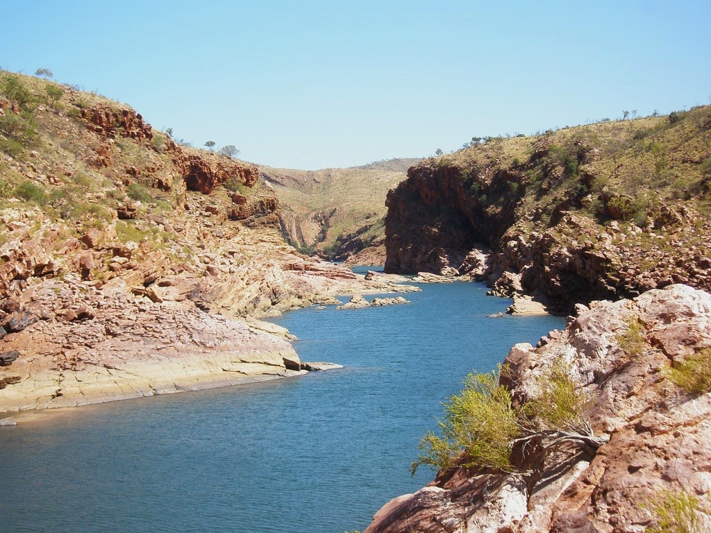
We then were driven to the main part of this station, stopping at the warm Zebedee Springs for a glorious soak, especially under a small waterfall. Lunch was barramundi or steak, both excellent in this part of the world, then it was time to be taken to the Chamberlain River for a cruise through the Chamberlain Gorge. We only saw part of its 128km length, but it was wonderfully impressive.

We moored in what the crew call their fish sanctuary . . . only because the archer fish,  
The wonderful Chamberlain gorge
catfish and big barramundi there know that when a boat moors, they get fed.  We saw many at close quarters, and as well as feeding them, the crew plied us with champagne and fresh Ord River fruit such as three different kinds of melon and starfruit. 
Fish food in one hand, bubbly in the other.


By the time we were dropped off in Kununurra that evening, we’d been enjoying ourselves for 12 hours, so once again, we fell into bed.

Everything is working well on the truck again, with batteries replaced, and today it got a new set of rear tyres. We’ve tried out most of the restaurants and cafes attached to touristy places and have had some great food experiences.

Tomorrow we’ll go to the local markets again but now we know what they serve, we’ll have breakfast there. We have some more exploring to do around the farming areas and have promised ourselves a sunset from a rocky lookout above the town. We’ve checked out the Argyle diamonds in some shops here, but because the pink ones are incredibly rare (we’re told only a champagne glassful is found each year) even the smallest chip is worth thousands of dollars, and the champagne-coloured ones are not far behind in price.

Before we know it, we’ll be handing back our little hire car, packing up the Isuzu and heading east to Victoria River, on the way to Katherine.

Monday, September 01, 2014

Water everywhere at Kununurra


We’ve had almost a week in Kununurra, sorted out batteries and tyres, staying in a delightful caravan park with a palm-fringed pool just across a narrow street from our site. The temperature has been in the 30s each day, cooling nicely in late afternoon, so it has been really pleasant.

We are really doing the tourist thing, taking tours and hiring a small car to get around, rather than  

Sunset on Lake Argyle.
unbuckling the motorhome from power and water and taking in its annexe. This morning we booked in for another week, so we’ll leave on September 9.


Our first tour was on Lake Argyle, going by small bus from Kununurra the 78km to the lake, formed by the Ord River Dam. We visited the old Durack family homestead at Argyle Downs, that would have been ‘drowned’ when the lake filled, but was taken apart and reconstructed, stone by stone. There are gravestones there for family members, including Elizabeth and Mary Durack, so we paid special attention to that of Elizabeth, as she’s the mother of our friend Mike Clancy in Brisbane (I went to school with his wife Marg).

The inland sea of Lake Argyle.
Then the 8 of us boarded a 50ft catamaran for lunch and a full afternoon cruising and swimming on the lake. It is so big it is classed as an inland sea. Its sole purpose is to keep Lake Kununurra, 55km downstream on the Ord, topped up as it’s the one that supplies irrigation water for the whole Ord River Irrigation Scheme.

 Apparently it would take the water from five Port Phillip Bays to fill Lake Argyle and I can well believe it. It is supposed to have 25,000 freshwater crocs living in it but we only saw one basking on a rocky shore. 

One of the passengers swimming in the lake.


After seeing the sunset from the catamaran, we eventually landed and were driven home in the dark.

Our own private wanderings have taken us to Wyndham (fairly dusty, depressing little town where everything was shut on a Saturday morning) where we wound our way up a long hill to the Five Rivers Lookout. That shows Cambridge Gulf, with five rivers emptying into it, including the Ord.

There’s a fascinating striped rock found near here called zebra rock and we’ve visited the two places that have galleries of items made from that rock. One was beside Lake Kununurra and had catfish near a little jetty that one could feed. The original pumphouse for the irrigation, now disused, has become a restaurant, and also has dozens of big catfish lurking, waiting for diners on the verandah to throw over some bread. 

An albino catfish among the feeding frenzy.

We were interested in how the irrigation scheme is going as there have been many agricultural disasters with sugar and rice, for example, as well as cotton-growing.

We’d been told that Indian sandalwood is the new ‘wooden gold’ with a huge export market into Asia where it’s burnt in temples all day every day. Sure enough we saw lots growing, as well as big plantations of mangoes.

We couldn’t work out why the sandalwood plantations seemed to have various varieties of trees, but a most information visit to a Sandalwood factory informed us that the young sandalwood trees need certain host trees, whose roots they parasitize, eventually killing them.


One of the great irrigation channels.
There are now 6000 hectares under sandalwood here, not nearly as much under mangoes, and we also saw crops of chia, sorghum, corn, cane, pumpkins, melons, & papaws. The great irrigation channels extend north-west from the town 48km  . . . we followed one of the roads out of interest, beside such a channel, only turning around when the bitumen finished.

We’re told that new area we saw is the second stage of the scheme, and if we’d driven another 10km, we’d have been in the Northern Territory, where in fact the irrigation scheme is to be extended. 
A huge paddock of chia in the extended irrigation area.
There is such a supply of water here that the caravan park has signs up encouraging campers to use the sprinklers left around the place to keep the place looking green. John has turned into a right little sprinkler-holic, setting them up all around our site whenever we’re in residence.

Tomorrow we will do a flight from here to the Bungle Bungles, land, do some walking in the gorges, have lunch, then fly back, taking in the Argyle diamond mine, Lake Argyle and the irrigation areas from the air. A few days later we’ll be taken on a tour of El Questro, involving gorge-walking and cruising and lots of swimming.

We had intended ending our run along the Gibb River Road with a stay at El Questro, but this will be much better, being taken around in someone else’s vehicle.

We had to take our Avis car back to the airport this morning (no point in having one when we’re away on tours). It’s a nuisance having to collect and deposit a car at the airport, so we’d already arranged to get a Hertz car from a depot in the town for next weekend. While at the airport, two big Chinook Army helicopters had landed, and quite a lot of people had come out from the town to watch them take off again.
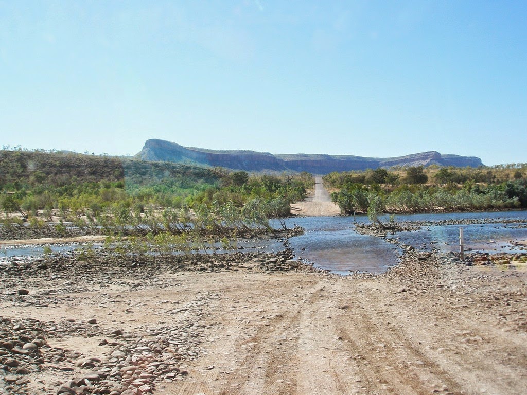
The original Ivanhoe Crossing of the Ord River, now
closed to vehicles.
One of the locals told us that when a Hercules lands, people rush out from town, as they can hear it’s different from the planes landing and taking off on tourist flights, or the commercial flights to and from Darwin, Broome and Perth.

Obviously, not a lot happens in Kununurra, but we like it a lot and have found quite a lot to do here. 

A final thought. The colours of the Kimberley are not just red rock and blue sky. There’s a lot of those two, obviously, but there’s also the straw colour of dry season spear grass and spinifex, the pale green of lots of smallish trees, bright green of new spinifex coming through after burning, and the blue-green of the waterways, particularly around Kununurra.


Tuesday, August 26, 2014

Gibb River Road


This will be an episodic post as we’ve been out of internet service for about 10 days:

August 20:

After a restful three days in Derby . . . explored that old port town; found jam, fruit cake, honey and scones at the Saturday markets in the CWA cottage grounds; and discovered a butcher with not only fabulous meat but also lots of frozen barramundi and threadfin salmon . . . we stocked up with groceries and left town, pausing only to view the old prison boab and the longest cattle trough in the southern hemisphere.

500 cattle could drink at once from this trough.
The boab, of huge significance to the local Aborigines, is believed to be 1500 years old and was so big, with a hollow interior, that it was often used to keep prisoners contained on their way to Derby jail. The trough, attached to a bore, was used to water stock arriving at the town and could water 500 at a time, being 322m long.

Then we left town, but stopped on the Gibb River Road after only 3km to visit the Mowanjum Arts Centre, a glorious building hosting work by local Aboriginal artists. I’d done research on their website and knew we wanted to see some work by some talented sisters, one of whom specialises in Gyorn Gyorns, slim black figures. We found one that we liked and it’s to be posted to us at home in late October.

The prison boab in which men were held.
Just another 10 or so kms on, we stopped for the day at Birdwood Downs, a property run by the US-based Institute of Ecotechnics. It’s owned it since the late 1970s and has restored badly-overgrazed land to improved pasture. There’s a small campground and a set of nice little cabins surrounded by flourishing bougainvillea, and a pineapple and banana orchard, as well as horses and cattle. We were the only campers for some hours, then a Welsh couple arrived in a tiny little Suzuki with a ‘topper’ tent which unfolded on the vehicle roof.

The next morning, we drove 124 km (and the bitumen ended, putting us back on red dirt corrugations) before turning south towards Windjana Gorge National Park.


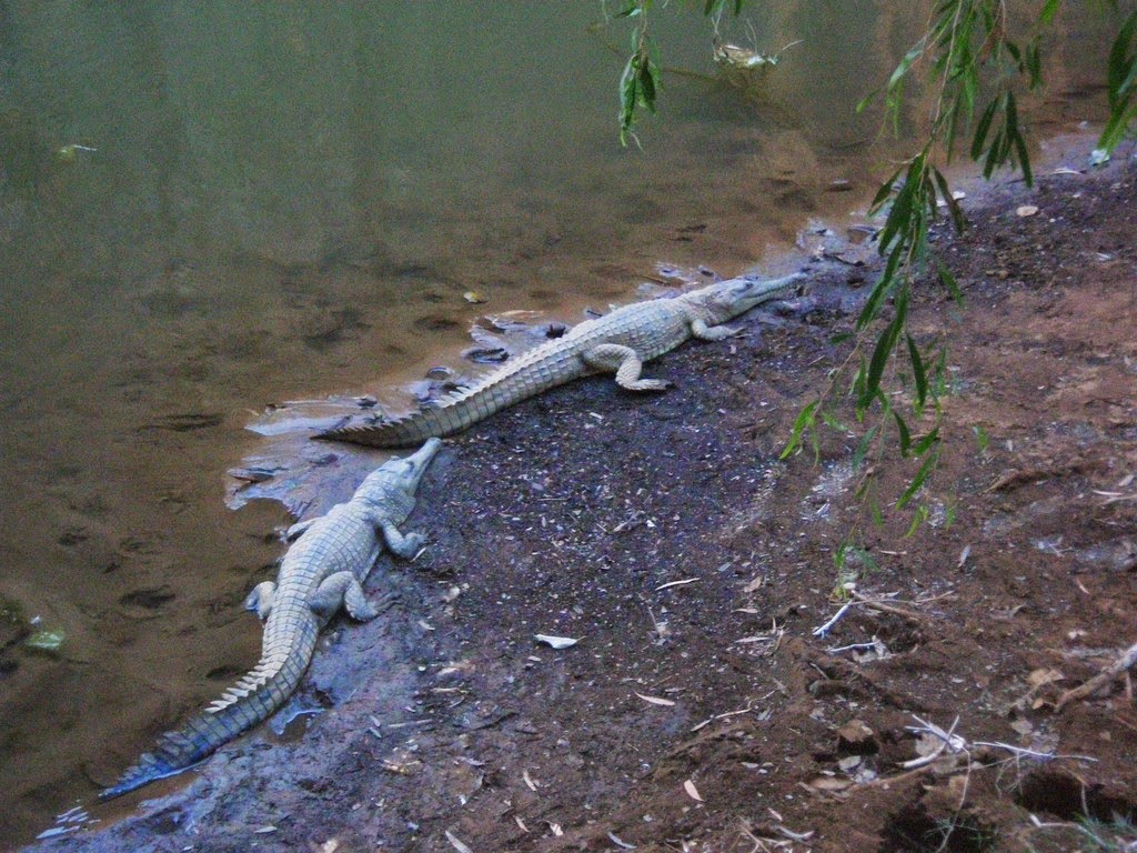
The campground has a dramatic backdrop of the Napier Range, an ancient Devonian-age reef through which a river has made its way, so the gorge walk is great, with freshwater crocs lying around in the water of the dry season pools. So definitely no swimming!

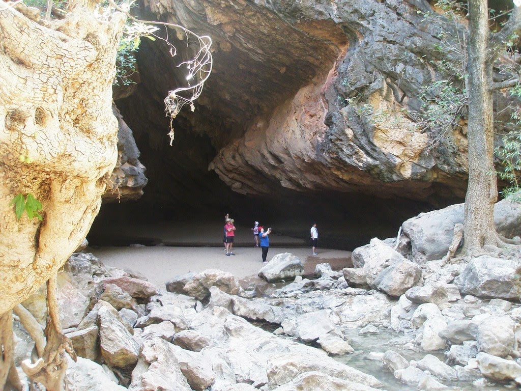
Another 35km down the road is the Tunnel Creek National Park, with a creek actually making its way through the range. So reef-walking shoes and a torch were necessary as the water was about up to our knees in places. The dirt road was appalling and it took us an hour to do the 35km but well worth it for the walk in the dark. 
Freshwater crocs at Windjana Gorge.


A National Parks volunteer had told us the day before to go outside the tunnel at the far end before returning and look for some Aboriginal rock art about 50m along the creek edge. This we found, much to our delight, but most people just came to the end of the tunnel, and turned around for the return journey.

The end of the tunnel.
We’ll have another shortish drive tomorrow to Mt Hart, about 50km north of the Gibb River Road, a former pastoral property now controlled by the WA Dept of Parks and Wildlife as a conservation park, with the homestead accommodation and campground run by the tour company APT. It has some pretty gorges . . . and a bar and restaurant!


August 23:

We had a wonderful time at Mt Hart, an oasis in dry season Kimberley weather. The manager was Bob, who’s there with his wife from Tumbulgum in the Tweed area for a few months. There were only a few other groups in the campground beside the Barker River, with a nice swimming hole right there. As well we drove to some other pools and gorges, having them all to ourselves, which was great.
Cooling off in Annie's Pool.
The DPaW is trying to destock the million-acre property, where it seems nobody made any money out of cattle, as they could fatten them all right, but mustering them out of the mountains and gorges was nigh impossible. Just before we arrived a contractor had managed to muster around 800 and they got trucked off to meatworks. But when we drove to some little gorges we saw some big old scrubber bulls that’ve obviously been hiding out for some time, as well as a family group of a bull, some cows and calves, and there were plenty of cowpats everywhere, so some more destocking is needed.

Reluctantly we left Mt Hart, which has an airstrip right beside the two homesteads and lush garden. Quite a lot of people fly in by light aircraft or helicopter and a very funny sign greets them.

 
We drove the 50km back to the Gibb River Road (only took us 1.5hrs) and went on to the Imintji Store, run by the local Aboriginal community and staffed by young backpackers. We had a real coffee and some freshly-baked muffins, and stocked up with some groceries and frozen bread and meat. Just as we were paying for that, a lad brought a basket of fresh baguettes out from the kitchen. We pounced on them at once, buying all four, especially when we were told that they were made by a French pastrycook.
A bustard out for a stroll on the road.

Imagine, on the Gibb River Road, baguettes that tasted as if they’d just been baked in Paris!  That pastrycook then emerged with a fresh apple pie that another customer was having with coffee. Yumm!

On we went, turning off about 25km later for an 88km, rather gruelling drive to Mornington Wilderness Camp, run by the Australian Wildlife Conservancy. There are two spectacular gorges here for us to visit, yet another bar and restaurant, and camping beside a little creek. We’re looking out at pandanus, paperbarks and ghost gums on the side of the creek.


Staff have warned us that a young female dingo has been seen lurking around the campground, so said we should leave nothing outside . . . such as shoes, books, hats etc as she may take them away. They’ve set a trap for her and will remove her to some other part of the sanctuary, a former cattle station that covers 322,000 hectares. It’s been destocked, allowing the native vegetation to recover and the populations of small mammals and birds to recover.

We’ll stay here three nights, exploring the area, then tackle that vile road back to the Gibb, where we’ll find another interesting place to stay.

August 26:


Dramatic scenery on the way to Mornington.
We left Mornington earlier than expected, but more of that later. We really enjoyed that place, bumping over 24km  of rough road to Dimond Gorge, one of the most beautiful in the Kimberley. On the way back to the camp we called into a swimming spot on the Fitzroy River, which was glorious.

That was when we discovered that our #$**! batteries had gone again so we hightailed it back to camp (where no generators are allowed) and managed to get some plastic bottles full of frozen water to put in the bases of the fridge and freezer to get us through the 
Fabulous Dimond Gorge
night, as we obviously couldn’t keep the truck motor running all night.


Close to the end of the Gibb River Road . .  Pentecost River
At the crack of dawn, literally, we were out of there, and the 88km access road took us almost 3 hours but once we were back on the Gibb, John just kept driving, stopping once at a roadhouse on an Aboriginal community to get fuel, and again for a quick sandwich beside the road.

In all, he drove for nine hours, and we almost covered the rest of the Gibb River Road, arriving at Home Valley station, which has an excellent campground, a bar and restaurant, where we got a powered site for the night.

Today, we set off on the final 30km of rough dirt road, with the bitumen starting about 33km before the road ends. That was when John got out to change the truck’s 4WD wheel hubs . . . and found one of the rear dual wheels had just gone flat, probably pierced by one of the sharp rocks. So he changed it, we tootled along into Kununurra, only about 80km away, saw a tyre bloke and arranged to get a complete new set of rear wheels, as those have done sterling service of 60,000 km around some of Australia’s roughest roads. That will be done once we get our auto-electrics sorted.

The tyre bloke gave John the name and number of a fellow who’s coming to the caravan park tomorrow morning. We’re booked in for at least a week, and the park is glorious!

Our site is under trees, including the distinctive boab of the Kimberley, everything is very lush and green, and we have already soaked in the swimming pool, just a few steps from our site.

One of the first things we did after making sure we had a caravan site was take the truck to a car wash and get rid of the Gibb River Road dust. It came off in great red gushes, a bit like it will leave our clothes when I wash them tomorrow.

We have no regrets about not calling at even more of the Gibb River Road places, because of our battery problem.  We think we’d already seen the highlights of the road, explored some wonderful gorges and were frankly, a bit ‘gorged out’.

Now we’re in Kununurra, there are several tours we’ll take, including a flight south to the Bungle Bungles, landing to do some of the walks ( more gorges!); a day at El Questro (where we had told ourselves we’d spend some time); and a cruise on either Lake Argyle or Lake Kununurra.


Friday, August 15, 2014

A perfect beach, a pearlshell altar, and teeth-rattling roads


We left Gambanan near the top of the Dampier Peninsula reluctantly and travelled back south along the way we’d arrived.

First port of call was Lombadina, not only because it’s an interesting Aboriginal community, but also because it was a Monday, and the settlement’s bakery produces bread on Mondays, Wednesdays and Fridays.

We called at the community office to get our entry pass (this is normal for most of these communities) and discovered that the gorgeous girl manning the office was French-Swiss. She was delighted to know that we’d been to her home city of Lausanne and that we’d also been to  Montreux, just a little way along Lake Geneva.
Lombadina's church
There was just one loaf of fresh bread not pre-ordered at the general store, next to the bakery, so we were lucky to get it. We then visited the church, a lovely tropical place built in 1934 by the Catholic priests who ran the community and some of the locals, from mangrove trunks and paperbark for the roof. It was later roofed over with corrugated iron. At the local craft shop I bought a screen-printed sarong.

Lombadina is a delightful tree-filled village, with about 70 inhabitants, and unlike some Aboriginal communities we had visited, everyone works. We were told later that the priests who had run it as a mission, along with those at Beagle Bay, further south, had been in charge of children of mixed race taken by the government from their Aboriginal mothers  . . . the stolen generation.  
The original paperbark roof at Lombadina.
About 50km south we turned off the bitumen road onto a fairly bad, corrugated, sandy track that goes west to Middle Lagoon, a popular campground. We turned off it and kept following the signs to the Gnylmarung (pronounced nill-ma-rung) Retreat, right on the beach at Beagle Bay, run by Alphonse and his wife Delma, as an outstation of the main Beagle Bay Aboriginal community.

It has fairly basic camping facilities, but there are barbecues for most campsites, what are described as ‘water sinks’ . . . and they’re just that, with a double sink standing on a frame, with a tap and a hose, and water from the sinks just goes onto the ground.
The road into Gnylmarung.
There are banks of solar panels to run the water pumps and lights for the amenities block, and in the middle of the campground is a towering solar-powered block which is a satellite phone, offering free calls to any landline in Australia. There’s no mobile service unless campers have special aerials. Because the power is solar, there’s also a free laundry, instead of the usual $3 or $4 needed for caravan park machines.


And then there’s the beach! It is a perfect curve of white sand, turquoise water and dramatic rock formations on the headlands. Because of the huge tides in the area, most of the water in this little bay drains right away as the high tide drops up to nine metres to low tide level. We’ve walked the beaches, swam in the clear water, and marvelled at the reefs and rocks emerging at low tide.

Bushfires in the distance at Gynlmarung, at half tide.
The campground has free firewood available so we’ve had roaring fires most nights. This is only because a nice retired man from Melbourne spends six months here each year giving Alphonse and Delma a hand with their fairly new tourist enterprise. He and a mate go off each day and cut firewood which is then placed in a trailer in a central position, with wheelbarrows available for campers to distribute it to their campsites.


Low tide, with reefs and firm sand.
His wife flies up to Broome each year for the month of August and this year their daughter and son-in-law and three kids have called in on a three-month lap of Australia to spend time here also.

Other campers include three couples from Lake Macquarie, accompanied by boats and caravans; and a few other couples in camper trailers.

We’re starting to run out of food so will leave tomorrow, explore a couple more places on the peninsula, then tackle that vile dirt road on the way south, arriving back on the bitumen just north of Broome. From there we’ll head north to Derby where we can re-group, re-stock, and get ready for our next adventure . . . the 600km Gibb River Road, which we may take a couple of weeks to negotiate as there are lots of stations offering camping along the way, as well as lots of gorges and wilderness areas to visit.

Postscript:

The red cliffs of the Kimberley at Whalesong.
We left Gnylmarung as planned, calling at Middle Lagoon,  which was full of campers right on the cliffs, then had coffee at a little cafe called Whalesong.  It’s the home to an Aboriginal couple and their four children, but they move out in the tourist season and the building is turned into a popular cafe, run by a couple of Caucasian women. The one who served us comes from Sydney but is a friend of the owners and has a partner in Broome, so is almost an honorary West Australian.

After we had tackled the rough road out to the main road, we called into the settlement of Beagle Bay to see its beautiful church decorated with pearlshell, built by the German order of priests who ran it, while under house arrest in World War I. It’s a glorious piece of history and apparently built from a picture of a German country church one of the priests had. 


Beagle Bay's Sacred Heart church, decorated with pearlshell.
The locals and the priests made all the clay bricks and as there was no cement, used lime made burning shell as mortar. In 2001 the bell tower collapsed after surviving almost 90 years of cyclones and baking heat, with just that lime mortar, but it was rebuilt in 2002 and the little church looks fabulous in its white outer paint.


Not a German country church, but in
 remote Beagle Bay, WA.
Then we girded our loins, checked that all our back teeth were cemented in place and survived the  86km of rough red sandy corrugations before reaching bitumen again.

We had intended turning left when we reached the Great Northern Highway, just out of Broome, and heading towards Derby, but luckily decided to duck into Broome (only 10km) to get some of life’s essentials that we had run out of, such as chocolate, beer and wine.

When we returned to the truck after buying these, we found the electric steps didn’t work. John climbed in, and found that after a week of wonderful full power during our off-the-grid camping, we had absolutely none. Zilch, nada, nothing!

So back around to the auto electrician we drove, who could not believe his readings when he tested the ver-r-r-y expensive batteries we’d had to wait for a week to arrive from Sydney. One was fine but the other was so dead it was giving a negative reading.

Once again luck intervened, as he’d had another batch of those same deep cycle batteries delivered and had sold all but one, so he replaced the ailing one, all the time shaking his head and determined to get to the bottom of its non-performance. It had a three-year warranty, so there was no cost to us and he was determined to have strong words with the manufacturer.

By then it was late,  late afternoon so I phoned the caravan park we’d stayed in for two weeks and organised a spot for the night, with them leaving our gate pass on what they call the ‘late board’ as by the time we arrived, after collecting a cooked chicken and some salad, it was around 7pm.

To say it had been an eventful day was an understatement, and naturally we slept like logs, before getting underway today on a most uneventful 200km drive on bitumen all the way to Derby.


Saturday, August 09, 2014

Through fire and smoke to a campsite beside the sea

A bushfire delay on the red, red road along the peninsula.

And so we left Broome, after almost two weeks there. We’d had a great time, and best of all, our house batteries had been replaced and everything was working well.

We’d heard there had been bushfires on the Dampier Peninsula, north of Broome, and in fact had seen some when flying over it almost a week before on our way to the horizontal waterfalls. The road was closed because of the fires the day before we left, but open when we started.

The first 14km or so are sealed, then there’s 80+km of fine red sand and corrugations, then 115km of sealed road, linking a lot of Aboriginal communities.

We were about two-thirds along the dirt section when we saw lots of smoke ahead, then flashing lights, and a Rural Fire Service vehicle was parked across the road, stopping traffic. The chap told us there’d be a short wait while they did a bit of back-burning along the road, so a minor convoy  
Waiting in line.
formed behind us and eventually we were led through a fairly smoky bit by a small fire tanker.


Even further on, there was another smoke cloud and the fire was right beside the road, but once past that, the air cleared and soon we were on the big stretch of bitumen.

We bypassed lots of little communities that offer camping, heading for Cape Leveque, then turning right towards the final settlement. Just near a pearl farm we spotted the turnoff we sought: Gambanan. Like all the campgrounds on the cape, it is Aboriginal land and cared for by a particular family, who’ve put a caretaker there to collect fees, clean the toilets etc. He’s a bloke from Bonny Hills, near Port Macquarie, who’s been on the road for two years in a camper trailer with his wife. They each work at the nearby Kooljaman Resort, Theo as a chef and Pam in the resort cafe.

This is a very simple campground with basic facilities like flush toilets and cold showers. The ground is all fine grey sand (where it’s not fine red sand!) so we have a bedtime ritual of washing our feet.  
The serenity of Gambanan.


The campground is only separated from the sea by rocks and there is a small sandy beach about 15 minutes walk away.

Theo warned us not to swim as a croc has been spotted there so we enjoyed a walk but didn’t venture in.

It’s been pretty multicultural, with an adventurous Italian family packing up to leave this morning. They are on a month’s holiday in Western Australia. Last year they had a month in Queensland. They have a hire vehicle and tents and after leaving here, will tackle the Gibb River Road, which is one of the roughest, most gorgeous parts of the Kimberley. The afternoon they arrived they were starting to dive into the water from the rocks until Theo spotted them and told them about the croc risk.

A Dutch couple were near us and as the sun set, he tried out the didgeridoo he’d bought somewhere. It all sounded just right for the surroundings, with lots of the signs around the campground in the language of the local Bardi people.

We’ve seen spectacular sunrises over the sea, as Gambanan faces east but this morning, a  
Spectacular sunrise.
combination of smoke and sea fog gave a spectacular show. Broome boasts of its Staircase to the Moon, but we had a staircase to the sun today.


It’s quite eerie when the tide is full as the bay is full of deep turquoise water, not making a sound. It’s only when there’s wind and a bit of a chop develops that one can hear the waves slapping on the rocks. Otherwise the tide just comes in and goes out, noiselessly.

Customised coil holder.
The sandflies have been merciless and I’m their particular favourite so am itching and scratching and trying all kinds of remedies. We had mossie coils but only one holder, so John devised another from a fork whose handle had become a bit dodgy. He bent one tine up to hold the coil, and two down to poke into the ground  . . . and one broke off! It is most effective.

We left our chairs, ground mat and bits and bobs on our site at Gambanan to go exploring. First was One Arm Point, the local aboriginal community (called Ardyaloon). We had to pay $10 each to enter the community, which seems well-organised and prosperous. Right at the end of the peninsula is the local trochus hatchery and aquaculture centre. It all seemed a bit ramshackle and the South African girl in charge just told us to have a look around, with a tour scheduled in about an hour when a bus arrived. We duly looked around, found one large circular tank obviously breeding trochus and some of the others had one or two fish in them, but nothing as we had imagined it. There were some polished trochus shell for sale . . . but we’re certainly not taking up shell collecting at our ages.
 
One of the signs at Gambanan.
Then we drove back along the road to the Cygnet Bay Pearl Farm, about the only privately-owned bit of land on the end of the Dampier Peninsula. One family, the Browns, have been cultivating pearls there since 1946 and they have a glorious gallery full of wonderful pieces of pearl jewellery.

About the only one that really appealed was a twisted rope of gold and white baroque pearls for just $20,000 . . . so that stayed firmly in its display case. We inquired about camping there, as it does have a small campground, but sadly, our vehicle is too high for the fairly bushy approach road.

On we went to the Kooljaman Resort, jointly owned by two of the Aboriginal communities and featuring a range of accommodation (but once again, we were considered too large for the campground) from cabins to safari tents.


The swimming beach at Kooljaman.
So we hightailed it back the 14km to Gambanan, which was almost deserted and gloriously serene. We watched the tide go out, further than we had seen it in previous days, as we’re starting to get the tidal difference of about eight metres. We’ve decided to stay at least two more nights, then will head south along the peninsula, trying to stay at some of the other community-run campgrounds.


Monday, August 04, 2014

Full speed through the waterfalls


Our first view of the gaps between the rocks,
called the horizontal waterfalls.
We’re still in Broome, but hope to be on the road again by the end of the week. This will mean almost two weeks here, but we’ve thoroughly enjoyed it.

Last Friday we took a seaplane to the wild Buccaneer Archipelago, supposedly of 1000 islands, well to the north of Broome, to go by fast boat through the horizontal waterfalls, formed when the rushing tide forces its way between outcrops of rock.

Broome from the aircraft.


We took off from Broome airport and took 1.5 hours to reach the floating tour base, where seaplanes land, boats take off and passengers are not only watered and fed, but on some tours, can also stay the night.


One of the boats that take passengers
through the waterfalls.
The flight took us over the Dampier Peninsula, where we hope to wander and camp in the coming week, and once we’d landed we were issued with a different kind of lifejacket and boarded a fast boat. The skipper assured us the waterfalls were ‘pumping’ as the tide was coming in. In this area, the difference between low tide and high tide can be 8 or 9 metres so there’s an incredible force of water.

We zoomed through the turbulent water of the first gap, which is about 20 metres wide, but the second gap, only 10 metres wide, was deemed too dangerous, as there was a drop of about 3 metres. The skipper assured us we’d try again later when the tide had settled down a bit.


Here we go through the first gap!
So back to the base, where crispy-skin barramundi had been cooked by one of the young crew, and along with salads and bread rolls, it made a wonderful lunch, with everyone encouraged to go back for more fish.


Then we watched one of the crew hand-feed some tawny nurse sharks that can swim around the floating base. Those who wanted to get closer went into an enclosed pool separated by mesh and using snorkels and goggles could see them as they snapped for portions of fish.
The floating base.

After that we went back in the boat and this time managed to get through the second waterfall, which had settled down a bit but was still very turbulent. The skipper then took us around some of the gorges and backwaters, including what they call Cyclone Creek, where all the sections of the base are towed in the wet season, well-protected from cyclones by high cliffs and deep water.

When operations start again around April, a crew returns to take it all out into open water, where the seaplanes can land and take off.

It was a most interesting day, ending with an hour-long flight back to Broome on a more direct route.


The heavily-weathered gravestone of one
of the Japanese divers.
We’ve watched people come and go from the caravan park and are starting to feel like elder statesmen. We’ve eaten out a few times, once at Matso’s Brewery, a great old building that had been one of Broome’s stores and was moved next to one of the old pearling master’s houses. As well as proper beer, Matso’s also makes an alcoholic ginger beer and a desert lime cider. We just love the ginger beer.


Matso’s is named for the Matsumoto family who operated a store in the building. We found the burial place of some Matsumotos in the Japanese cemetery we visited on Sunday after yet another breakfast at the markets.

There are 900+ Japanese buried there, the vast majority of them divers who died as a result of the bends, cyclones and other disasters when working the pearlshell industry. There is also a Chinese cemetery and a small area marked Malay and Muslim.

We’ve explored the port area where the service vessels for offshore rigs load lots of gear and today plan to have lunch at a restaurant there. There is what I call an open-air picture theatre here (locally called a picture garden and deemed to be the oldest continuously operating in the world) so we plan to go to a film there on Tuesday night, sitting in the canvas deck chairs I remember from my youth in North Queensland.