Monday, July 18, 2016

A magical night in the desert


July 17
After we jolted our way out of Palm Valley, once again, driving quite a lot along the bed of the Finke River, and past the sort of river gum and red rock landscapes made famous by Albert Namatjira who lived in nearby Hermannsburg, we negotiated a relatively rough dirt road called the Mereenie Loop to reach Kings Canyon Resort.

There we stayed just one night, taking a walk in the canyon that afternoon. It’s touted as being Australia’s answer to the USA’s Grand Canyon, but it really isn’t. There’s a longish walk around the rim we could have done, but as that means a steep climb to start, and we really only have two good knees between us, we opted for the shorter walk along the creek bed.

There were notices everywhere in the campground about not feeding or encouraging the dingoes or wild dogs, and they seemed to be everywhere, slinking around. We’d seen one trotting along the
riverbed road that morning at Palm Valley and he seemed to be all dingo, but some of those around the Kings Canyon Resort caravan park were real mongrels.

Anyway, on we went the next day for a short drive (on bitumen roads) south to the Lasseter Highway, the main one from the Stuart Highway to Uluru, and we made a stop at a cattle station called Curtin Springs, where there is a campground. It also has a restaurant, bar and shop, and in the past few years has been making paper from local grasses, spinifex and desert oak needles.

We joined another couple that afternoon for a paper-making experience, which was fascinating. The Severin family, which has run this one million-acre station since the early 1950s, had diversified into tourism some time ago and to perfect the papermaking, Ashley and Lindy Severin travelled to paper-making workshops in Burnie, Tasmania. To establish the enterprise, they cleared out an old abattoir building beside a set of working stockyards, using a good deal of the equipment there and making what they needed out of other bits and pieces.


That afternoon John and I each made a small piece of paper from oats grass. They would take a few days to dry so they gave us some completed paper to take with us. We chose some from spinifex and native couch grass, one sheet of which was mixed with some of the tail hair they gather when doing bangtail musters (snipping the end hair from the tails when dealing with cattle in the stockyards so they know which ones have been into the yards, and it’s a way of counting them).

We had a great chat at the bar that night with Ashley, a Nuffield Scholarship winner in the 1970s, who now spends a good deal of his time dealing with the 16 backpackers he employs and the bureaucracy from various government departments . . . as well as his 3000 cattle.

It was less than 100km from Curtin Springs to Uluru and the Yulara Resort, where we were booked into the campground. There are also several hotels and apartments, a shopping centre, art galleries and a small theatre, medical, police and fire facilities, as well as a camel farm and an airport on the outskirts. It’s all arranged in a rough oval with a shuttle bus patrolling every 20 minutes.

An impromptu serenade
at a waterhole at the base of Uluru.
We did a guided tour to Uluru, about 10km away with just a New York family as the other passengers, so had a great five hours, walking and driving around the great rock. It looks so smooth from a distance, but is full of folds and crevices . . .  and hundreds of tourists on the walking track around its base. Our wonderful afternoon ended with sparkling wine as we watching the sunset change the colours of the rock, and by then the evening cold was starting to settle.
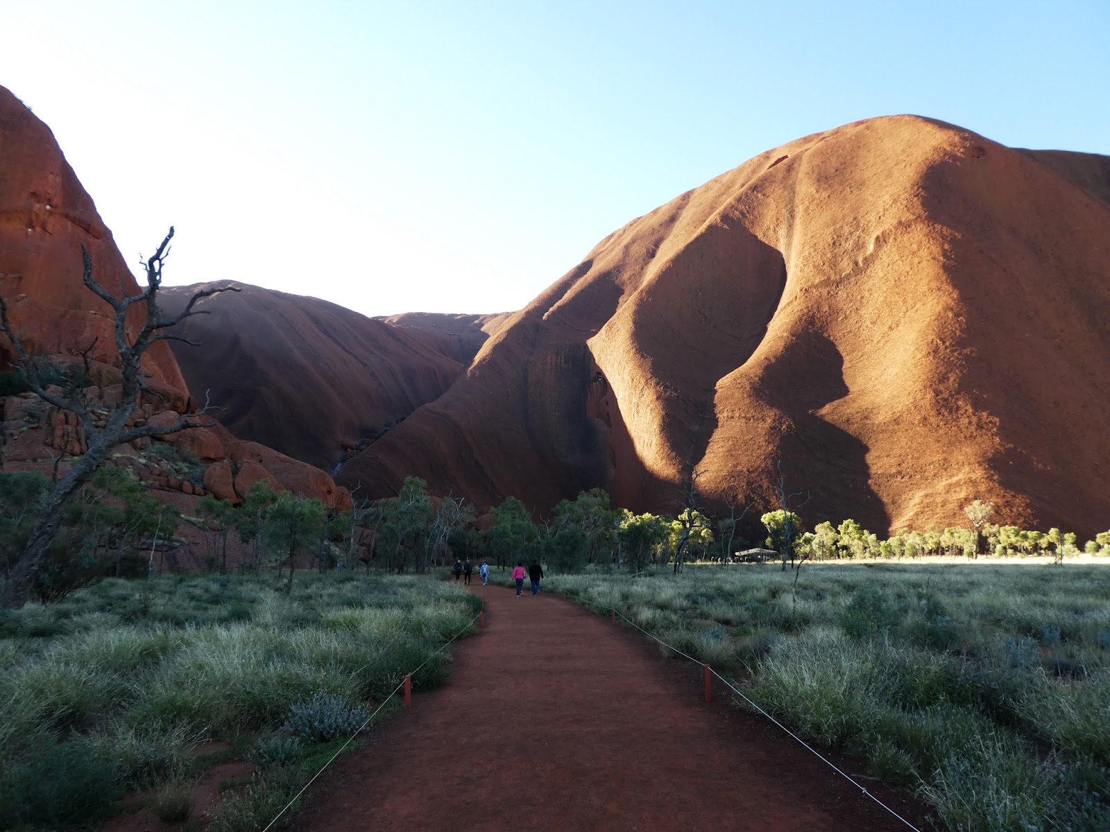
Some of the great folds and crevices in the Rock.
The next night was a magical experience at the Field of Light. This is an art installation of 50,000 handcrafted light stems, each topped with a glass globe, all working on solar power from 36 portable solar panels. We were collected by a coach that took us to a sandhill overlooking the area equivalent to seven football fields where the exhibition has been installed. After being plied with bubbly and superb canapes from the local five-star hotel, Sails in the Desert, as the light died we saw the globes starting to glow. When they were fully lit, we descended the sandhill and wandered the show along defined paths. There are 380km of optical fibre used in the installation so no straying from the paths is allowed.
At sunset: The Field of Light shows white.

Like much of the Central Australian landscape, it was impossible to capture the sheer scale of it in photos, but like everyone else, I tried.

Glowing in the dark.
We’ll spend our last day restocking the pantry and fridge, relaxing and getting ready for about five days on dirt roads, crossing the WA border on Tuesday. We have all our permits to travel through Aboriginal lands, big smiles on our faces, and you may not hear from us again for about a week, depending on where we find internet access.
Spectacular globes of light in many colours.


Thursday, July 14, 2016

Right in the Centre now


July 11 (more than 4000km from home)

Leaving Marree we drove about 70km on the Oodnadatta Track, then turned south to Roxby Downs and Woomera. It was a dirt road, but hard-packed after rain some days before, and very pleasant. A highlight was a set of sculptures close to the Roxby Downs turn-off, including some planes, with tail-ends in the ground, figures made of bits welded together, and one of the traditional railway water tanks (for the old steam engine Ghan, beside whose old track the road travelled) transformed into a dog.


From Roxby Downs we deviated to the opal-mining town of Andamooka, with much more mechanised mining than I had expected. It was not as extensive as at Coober Pedy, a day later, where for kilometres either side of the town, the landscape is a series of ‘molehills’ from excavators having extracted dirt, sieved it to find possible opal-bearing stone, and piled the leftovers.

Anyway, on to Woomera, which has special significance as my late sister and her family lived there for about 10 years to 1976. It is still quite a big town, though many of the houses are no longer occupied and some have been demolished. The rocket range is still used and there is talk of making it an official RAAF base, which
A reminder of Woomera's heyday as a rocket range.
will bring in more families. We met the principal of the school where my sister was a secondary teacher and he told me it’s still an Area School but has only 10 pupils, from one in kindergarten to one in Year 12 . . . and as everything in Woomera is still controlled by the Commonwealth Govt, it’s unlikely to close just yet, and certainly not if more families come in.

Then we joined the Stuart Highway, and drove north on one of our longest days (abt 600km) to a place called Marla, having a quick look at Coober Pedy on the way. We left Marla on a cold and windy morning, drove through torrential rain at times which at least washed off most of the Flinders Ranges mud, and arrived at Alice Springs on quite a hot day, so we quickly stripped off jeans and heavy jackets for shorts and t-shirts.

Would you believe that right next to us in a caravan park is a couple from Lismore, and I knew him years ago when he lived in Jiggi. (For members of my family, it’s Dr Keith Bolton).

A highlight of our day was the National Transport Museum and Hall of Fame, especially the Jack Hurley pavilion, honouring the late Kenworth distributor in Kyogle; and then the arrival at Alice Springs of the Ghan train from Adelaide, with 34 carriages! It was so long it could not all fit into the station in one stop.

A tribute to the Afghans and their camels

at the railway station.

We’ve acquired the last permit we needed to travel on Aboriginal land after we reach WA from NT; filled up with fuel; bought extra beer and water; and re-filled a gas bottle. We also took on enough supplies for about 10 days as tomorrow we leave for the West McDonnell Ranges, Uluru and then the Great Central Road.

We want to share some of the little things that have kept us amused on the road.

* We often hear truckies chatting to each other on the radio, and the other day one commented that caravanners were like potholes, ‘always in the road’.

* Then there was a Victorian caravanner (they’re everywhere!) who must have been watching old films about Smokey and the Bandit, as he prefaced several inquiries about passing a wide load with ‘Breaker, breaker’. Now that’s not something we hear much in Australia these days.

* When we reach caravan parks or camping areas and watch people backing caravans or camper trailers into their designated spots, often with a wife madly giving hand signals or even on a walkie-talkie, we recall an old bloke we met at Bedourie 2 years ago who used to say to his dog, “Come on, Dog, let’s watch Caravannus australis and their rituals” when a group of caravans would arrive.

* Yesterday afternoon, some chap wandered by our camp spot in the caravan park for a chat, a bit unsteady after his own personal happy hour, and when he heard we were heading for WA, insisted we must go to the Dampier Bowling Club, where camping parking is available behind the club . . . as long as you are prepared to do some stints behind the bar, not in front of it.

* Not everyone is aware of, or follows, the Outback protocol of greeting other drivers. Those who do have three versions: A full-blooded wave of the right hand and forearm; a raising of the right arm and hand in a kind of salute; or the more laconic one or two-fingered salute with the right hand still firmly gripping the steering wheel.

July 13

Another instalment: there was no internet coverage in Alice Springs. The caravan park wi-fi didn’t work (they blamed the NBN workmen nearby) and even our Telstra hotspots would not hold (so we blamed the NBN chaps also).

We headed west to the West MacDonnell Ranges, which are just glorious. All those Central Australian colours were present and jostling for attention. There was the deep red of the rocky hills and mountains, the bright green of fresh grass and spinifex, white of the sand in the creekbeds, and occasionally, the bright blue of the sky. It was cloudy and getting colder and windier each day as we traversed the ranges, visiting gorges and waterholes, chasms in the rocky hills, and finally spending the first night in the National Park campground at Ormiston Gorge.

From there we went south and east again to Hermannsburg, and then south down a strictly 4WD track to Palm Valley. It certainly was 4WD only and it took us an hour to travel the 18km to the campground. We decided to drive on the 4km to see the actual valley of palms, and that’s when the journey really got hairy. The track . . . which could not be dignified by calling it a road . . . climbed up and over boulders and through many creek crossings. We actually parked the truck on a rock slab and walked the last 1km or so as the boulders were becoming larger and sharper-edged. Smaller 4WDs were negotiating the track with some difficulty and we were so much bigger and heavier that we thought it best to be prudent.

In the end, we could see some kind of information shed, obviously all to do with Palm Valley, but our way was blocked by the Finke River and we had no intention of trying to wade through it on a rather cold day.

I might add that the road from Hermannsburg actually ran along part of the wide bed of the Finke River for several kilometres so the road shuts when the river is in full flow. After that adventure, probably the roughest road we’ve ever taken the truck along, and that includes Cape York and the Kimberley, we returned to the campground and set up for the night.


Friday, July 08, 2016

From Cobar to Marree . . . movies, ranges and fresh bread


It's two for one in this blog, as we've been out of service area for days (isn't it wonderful?) so there are two posts:
July  3

It was a big day of driving from Cobar to Broken Hill, through Wilcannia, but fascinating. Green, green growth surrounded us and at one stage John was sure we were seeing patches of white clover. I was a bit more sceptical, so we stopped to investigate . . . and it turned out to be small white wildflowers popping up after recent rain.

Lots of goats were grazing either side of the road, quite a few sheep, and just a few cattle, as well as small groups of emus. The Darling River at Wilcannia is a bit sluggish, but there’s nothing listless about all the caravans, motorhomes and camper trailers on the road. There was an enormous queue for diesel in Wilcannia and many were heading for Birdsville, via SA.

For those of you who know their Australian history, particularly its mining history, you’ll be delighted to know that we spent the night at Mt Gipps station, north-west of Broken Hill. It was there, in the days when the station covered one million acres, that a boundary rider, one Charles Rasp, found an interesting rock on a ‘broken hill’ and he and six other men from the station registered a mining claim that eventually became BHP.

Mt Gipps, today only a property of 82,000 acres, runs Dorper sheep, a meat breed that does not need shearing. The owners, John and Kym Cramp, have started a small tourism business, using former shearers’ quarters as accommodation, as well as just a few caravan/motorhome sites. We thoroughly enjoyed one night there, then went into Broken Hill to do a heritage walk, check out a museum, try to stay warm in absolutely freezing, bleak conditions, and took a drive north-west to the former mining centre of Silverton.

It’s now just a small village, with several artists running galleries, and the day we visited, it was full of technicians, their vehicles, and a hive of movie-making activity.
The rain scene at Silverton.

Outside one of the galleries, a friendly driver told us it was an HBO production, for the third season of a series called The Leftovers (never screened in Australia) with most of the crew from Melbourne, and others from the US. He was waiting for the director’s PA, who was in the gallery trying to find just the right gloves for the director, who did not want to leave after two weeks of filming without a pair of woollen Aussie gloves.

As we watched, from an elevated position, two huge gantries started spraying water on the action below. The driver told us it was to create rain for a particular sequence. All most interesting, and one look at the huge assembled technical crew (apart from any acting talent) explained why movies and TV series cost so much.

We stayed in Broken Hill overnight, then left for another fairly long drive into South Australia, through saltbush country to where the Flinders Ranges start to appear. During a quick stop in Peterborough we were lucky enough to see the Indian Pacific train go hurtling through on its way from Perth to Sydney.

North of there, we turned off the bitumen onto a rather wet dirt road leading to Almerta station, where we’d arranged to spend a night.

What a delight it was. Friendly people, and a wonderful campsite in the pebbly bed of a wide creek. We had it all to ourselves, were provided with firewood for a lovely campfire (but the cold
In the bed of the creek on Almerta station.

eventually drove us into the motorhome) and were even loaned a book on the area’s history. It’s coming up a busy time, and the family running sheep here have already told their three children they’ll be spending their school holidays marking lambs. It’s been a family concern for three generations, and they also run a shearing and crutching contracting business, with 20 people working in SA and NSW for 11 months of the year.


July 7
After a fabulous few days in the Flinders Ranges, which so impressed us we ran out of superlatives to describe them, we headed north to Maree, which was not only getting ready for the Marree Camel races, but also hosting some of the 7000 people who had attended the Big Bash at Birdsville and had driven down the Birdsville Track on their way home.
We spent several hours driving around the Flinders Ranges National Park, from our nearby base at Rawnsley Park station, which has quite a sophisticated range of accommodation, ranging from a caravan park (where we stayed) to cabins and eco-villas (not sure where they differ, maybe the eco-villas have long-drop toilets!). There was also a restaurant, where we washed down lamb and kangaroo meals with a local red.
We jolted around 4WD tracks through the park, with some of them actually running along the beds of creeks. The geology of the gorges is amazing, spectacular, and colourful and markers along what is known as the Geological Trail told us how old some of the rocks were . . . from 525 to 600 million years.
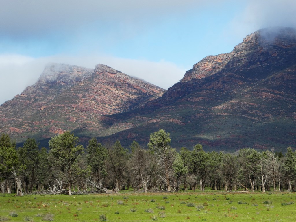
The glorious Flinders Ranges
It was a cloudy, slightly cold time, so we didn’t have a joy of seeing those rock formations with sunshine on them. The motorhome is no longer pristine, with quite a bit of mud underneath, but not doubt it will get worse.
A work in progress . . . the old post office.
Then on we went, north to Blinman, and then west to Parachilna, through more spectacular gorges, and we reached a main road spearing north into the great flatlands of Sou
th Australia, past the great coalfields of Leigh Creek until we reached the fascinating area of Farina.
It is just a collection of stone ruins, like many other ruins in this part of SA, but the difference is that there is a restoration group which annually travels from many parts of Australia to work on those buildings. Along with that work, they bring a bakery caravan and marquee, with signs on the main road that the bakery is open bringing large numbers of travellers.
The 1880s underground oven at Farina.
The baking is done in an underground oven built in 1880 and restored about seven years ago. We bought fresh bread rolls which we scoffed for lunch, then checked out the bakery chamber where two volunteers were trying to decide if a tray of pies was ready or not. The retired Army baker who’d made them had retired for a rest, so there was a bit of debate going on, and much laughter.
The volunteers with their pies.
We helped their fundraising for the restoration project by buying two bottles of the Barossa wine they’d had specially labelled Farina Restoration, enjoying the first that night at Maree, about 50km north, where fellow campers included many who’d driven in from Birdsville, and were looking forward to their first showers in five or six days.


Saturday, July 02, 2016

On the road again . . . to Western Australia


Left home June 30:

Brrrr! We thin-blooded sub-tropical dwellers really noticed that it was winter when we drove from Richmond Hill (Lismore, for the non-locals) through Casino to Tenterfield, then turned south to Glencoe, south of Glen Innes, where we spent the night in the driveway of a niece’s home.

All seven of us dined that night at the Red Lion Tavern, the focal point of that little town on the New England Highway, with big open fires really warming the blood . . . as well as the red wine.

Then off we set the next morning, having woken to find it was 8C inside the motorhome, and 2C outside, so on went the diesel heater. South we drove to Armidale and Tamworth, then we headed west to Gunnedah, busy and prosperous, though cold in the bright sun. We were delighted to see the country between Tamworth and Gunnedah a bright, fresh green, the result of recent rains, and so it continued, with water lying around even as far west as Cobar. By then we’d travelled more than 1000km from home.
The green paddocks go on forever.

When we reached Coonabarabran, we decided to head due west so we could visit Siding Springs Observatory, and stay at the Warrumbungle National Park. Up, up, up we drove on the access to the observatory, which had narrowly escaped disastrous bushfires in early 2013, as evidenced by blackened tree trunks all around, with newish sapling growth.

On top of the old volcano where the observatory is located, it was extremely cold and blowing a frightful gale. We were told later it had been the site of the deepest snow in the past week, so we were grateful not to have been there that day.

Try picking up the milk from the Sun! It's heavy!
We thoroughly enjoyed the visitors’ centre, complete with mind-boggling displays such as the comparative weights of a carton of milk on the various planets. Then we went up to the actual observatory, where from the visitors’ gallery we witnessed the great dome slowly rotating. We thought one of the huge apertures might be about to open, but one of the staff who came out to see us told it had just been done for a film crew which had been there months earlier shooting footage for a movie, and had returned for some more.

The full name is the Anglo-Australian Observatory, opened in 1974, and operated by the Australian National University, but despite the gravitas of its pedigree, there’s a slight frivolity outside the great dome with a steel sculpture of a bird holding a telescope to one eye.

Telescope in hand, the bird outside Siding
Springs Observatory.
Soon after we descended the mountain, we entered the Warrumbungle National Park, and set up for the night at a delightful camping ground, ready for yet another cold night, with a promised minimum of 3C the next morning.

As long as the water is hot for a shower, the kettle boils for tea, and we have plenty of doonas . . . and each other . . . we’ll stay warm.

Then on to Gilgandra, past an emu farm on a back road, with hundreds of the feathery chaps around the paddocks, then west past Warren and Nyngan to Cobar, where we arrived about 2pm. This gave us time to explore the town, particularly the Great Cobar Heritage Centre . . . it is ‘great’, but the name comes from the building’s first purpose as the admin centre for the first Great Cobar Copper Mine. It later was derelict, then a series of flats, before a community project turned it into one of NSW’s best museums.

        
The entrance sign to Cobar, celebrating its mining heritage, plus helpful hints from the museum.
As well as the pioneering and pastoral history, it is full of info on the town’s mining heritage, with five mines still producing copper, gold, silver lead and zinc.

We also discovered some interesting formulae for getting rid of flies or mice, and then peered into the green water filling the original open cut copper mine.

The caravan park is full of travellers . . . mostly from Victoria and some from Tasmania. It was warm enough to sit outside with sunset drinks and nibbles and chat with passers-by . . . the joy of travelling.


Wednesday, October 22, 2014

We're almost home


And so we left Lake Dalrymple and the people we had met there, including the ageing cattleman who was living out of the back of a truck, left, with a tarp thrown over it, while he took care of cattle he had on agistment on a nearby property. Until the drought breaks, that’s his life.
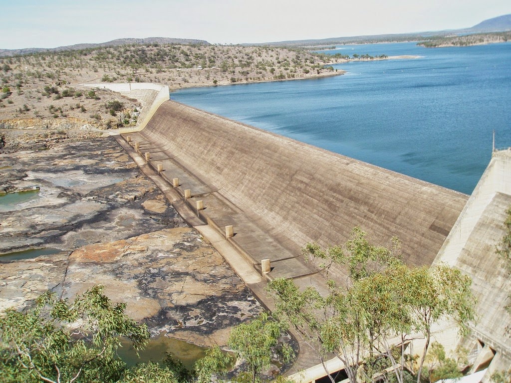
We drove across the base of the great Burdekin Falls dam spillway, then covered the 135km to Collinsville in several hours as it was a really bad dirt road. From then on, we were in the heart of coal-mining country with massive coal trains on the railway lines and good bitumen roads, so we headed south towards Nebo and stayed at Lake
Our truck dwarfed by the spillway at the Burdekin
Falls Dam.

Elphinstone, a natural lake where black swans and coots live and where local water ski club  members have a shed.


It was further south towards the Rockhampton-Longreach highway that we saw the first green grass in paddocks since we had left NSW all those months before, and even then, it was only fleeting.

After catching up with friends in Gracemere, on Rockhampton’s western outskirts, we went on to Yeppoon for three lovely nights with our friends, Judith and Barry.

We talked and laughed and ate and drank until we left on Tuesday morning, heading for Mount Morgan and Biloela and places south. We loved Mount Morgan, with its historic buildings, and ended our day at the Mulgildie pub, just south of Monto, where camping is encouraged in the pub’s backyard.


Lots of oversize loads were on the coal country roads,
including this giant bucket.
We had a great meal at the pub, chatting with the young Swedish backpacker running the bar, then fell into bed soon after 7.30pm, exhausted by our revelries of the previous few days.

Before reaching Monto we had detoured to the Cania Gorge National Park and Cania Dam so today we detoured again south of Monto to the Waruma Dam. There were masses of caravans and motorhomes camped right on the water’s edge but we weren’t tempted to stay.
One of Mount Morgan's old buildings.

Along the way today we bought groceries at Eidsvold and fuel at Mundubbera, where we started to see the citrus orchards for which the area is famous.  
We stopped early at Gayndah, as we were both tired, and tomorrow will make a final push to stay with friends near Pomona, then spend the weekend with family in Brisbane.

After that, it’s back to Richmond Hill and HOME!

Thursday, October 16, 2014

Across north-west Queensland


October 15: This is the day of writing, but don’t know when we’ll be back in internet service area to post this blog.


We’re happily camped high on a hill overlooking Lake Dalrymple, the waterway formed by the Burdekin Falls Dam, south-east of Charters Towers.

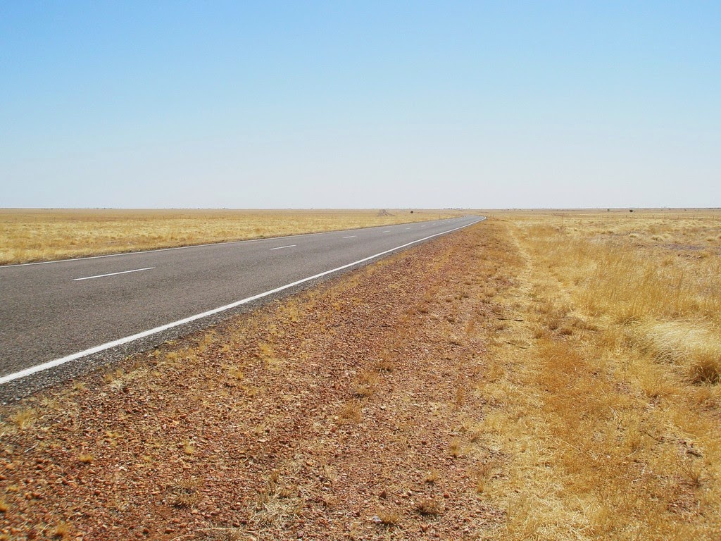
The country across the NT and Qld is as dry as dust.
To get here from Tennant Creek in the NT, which we left on Oct 9, first we called just outside that town at the old telegraph station, part of Australia’s communications history, then made a turn to the east at the Three Ways (just a roadhouse) and continued across the rather tedious Barkly Tableland until we reached Camooweal, where we spent the night in a small park behind the service station.


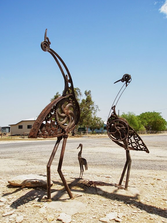
Brolga sculptures from old junk in the
 hamlet of Nelia
It was a short drive the next day to Mt Isa, where we wanted to catch up with the sister of John’s son-in-law, Chris. We had a great afternoon with her, spent the night in a caravan park, and left next day for Richmond. There we stayed for two nights beside the town’s artificial lake, a great place, with a paved path all around, lit at night, and a wonderful place for the locals to fish, ski and indulge in other water sports.

A storm blew up on our second afternoon there and we actually got some rain! The country is desperately dry and camped in the caravan park were some volunteers with Aussie Helpers, as well as the founder, Brian Egan. They had been going around the local stations, seeing who needed hay, as they had seven road trains of hay coming west from Bowen the next Friday. Graziers were invited to bring their trucks to town, where a barbecue would be held and they could collect their fodder. It’s all paid for by donations and run by volunteers.

One of them told us they had a camera crew going around with them, and in fact, they were being filmed the morning we left, sitting at one of the caravan park barbecue shelters, planning their day. The camera crew is from the UK and they are making a documentary on drought in Australia to be shown on the English-language version of Al Jazeera TV network.


Richmond is home to Kronosaurus Korner, a wonderful museum of fossils found locally when the area was part of a huge inland sea. The Kronosaurus was a particularly nasty bit of works, reproduced in fibreglass outside. The fossils are marvellous, including the most complete dinosaur skeleton in Australia, quite a small chap.

From Richmond it was only a short drive to Hughenden, which I hadn’t visited since I was a child, when we lived there for a few years.

On the way in I was thinking it was sad that I had nobody alive in the family to let know I had found and photographed our old house/school/or convent where my sister and I learnt music. As it turned out, I couldn’t find any of those places. The house has been replaced with something more modern; the state school is vastly changed and now caters for K-12; and the lovely old convent was torn down and replaced by something more utilitarian. The caravan park, near the railway station, used to be the site of the hospital when we lived there in the 1950s, so that was vaguely familiar.

It was a much cooler day after the storms so we drove 70km north to Porcupine Gorge, called Australia’s little Grand Canyon. It is indeed magnificent.


The Boer War memorial kiosk.
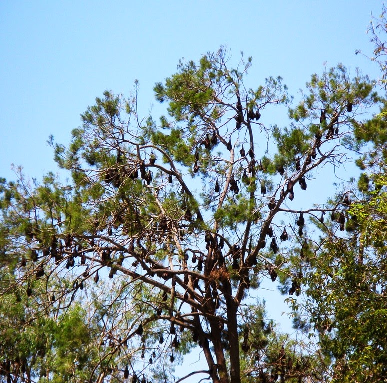
The next day, we went on to Charters Towers, had lunch in Lissner Park which is such a green oasis in the middle of the drought-stricken country all around. I thought the birds were chattering in the grand old trees above us until John told me to have a look . . . they were full of thousands of flying foxes! The lovely old kiosk, as it is called, was a memorial to the Charters Towers men who went to the Boer War, all horsemen. I had spent formative years of my adolescence in that town, so enjoyed seeing it again (that’s the third visit for me since 2007).


Some of the thousands of flying foxes in Lissner Park.
We decided to go towards Townsville, turning south at Mingela, through Ravenswood to the Burdekin Falls Dam, with a dirt road linking that area to Collinsville, for anyone who’s following us on a map.

The caravan park is the site of part of the village for the 1900 dam construction workers in the 1980s and we walked around this morning having a look at where some of the buildings were. There are still two tennis courts and what was an old swimming pool (there’s a newer one for the campers). The resident ranger told us when collecting the VERY expensive camping fees ($15 a night!) that he’s met a former dam worker in Townsville who told him they were really well looked after, with a bar and a store, and girls brought in on a Friday night, installed in a donger, and taken out on the Monday.


The Burdekin Falls Dam, with the roadway to the left of the pillars
at the base of the spillway.
There is a flock of peacocks here, apparently descended from a pair one of the men living in married quarters here during construction had in his garden. He left them here when the dam was completed in the late 1980s and apparently the flock built up to about 200 before some culling. Even the three peacocks still make a racket when they give their unearthly shriek, and their many peahens honk. Wallabies are everywhere, and so is their dung, but last night we sat outside and had about four feeding on leaves only a metre or so away.

There are not many campers here, but two have moderately large dogs. However one is blind and the other is very old and deaf, so I think the wallabies and peacocks are safe.

When we leave tomorrow morning we will drive across the bottom of the spillway towards Collinsville, obviously a way not available when water is rushing over the spillway. The ranger tells us it’s a fairly rough road, but as veterans of the Plenty, the Tanami Desert and the Gibb River roads, we’ll tackle it with good humour.

It promises to be a hot afternoon so we’ll take a dip in the pool and relax in the shade of the big African mahogany trees around the campground.


Thursday, October 09, 2014

Starting the long drive home


With some reluctance, but also some joy, we left Darwin on October 7, heading homewards after all these months.

We’d had a wonderful time in Darwin, parked in the driveway of the home of Fred and Lyn Barlow, with our stay extended to two weeks because of John’s operation (see previous blog) and the need for his surgeon to check him a week later.

We got the all-clear on Monday, Oct 6, so we were ready to go by the Tuesday morning.

One stop on the way south from Darwin was at a mango farm which produces the most glorious ice-creams. We’d had some at the open-air Deckchair Cinema in Darwin, John phoned, and arranged to collect some on our way south. So now we have the bottom of our little freezer packed with these 200ml tubs of tropical flavour.

Gorgeous boy at Mataranka.
We stopped in Katherine just long enough for me to catch up with a cousin there. We’d had lunch in Darwin with her sister and husband and the daughters of each of these cousins. They were all off to Singapore later this week to help the son of the Darwin cousin (Coral) celebrate his 50th birthday and recent marriage to an Indonesian beauty. So I was so glad we caught up when we did.

Then we drove down the Stuart Highway to Mataranka (about 38 C but no humidity, so it was actually a little more pleasant than Darwin) where we stayed the night.

We had to dissuade an over-friendly peacock and his harem from pinching our cheese and bikkies before dinner, but the caravan park was almost empty, showing that it really is nearing the end of the dry season.

Today we have driven more than 500km to Tennant Creek, just south of where we will go back to turn east tomorrow towards Mt Isa.

The countryside is dry and often quite burnt but there is still something wonderful about these Central Australian open spaces. Also wonderful, and mirth-producing, are the thousands of termite nests, many of which have been ‘dressed’ in t-shirts, caps and sometimes sunglasses by passers-by.

We couldn’t stop to photograph many as invariably we had massive road trains on our tails, but we certainly enjoyed looking at them.

Tomorrow we’ll have an easy day, just a few hundred km to Barkly Homestead, then on to Mt Isa.

We’ve admitted to each other that we are really ready to go home after all this time, and all the things that have gone wrong, although an enormous amount has gone right and we’ve seen some glorious parts of Australia.